|
Designed
for 1024x768 by
archeophotography.com
Homepage
|
|
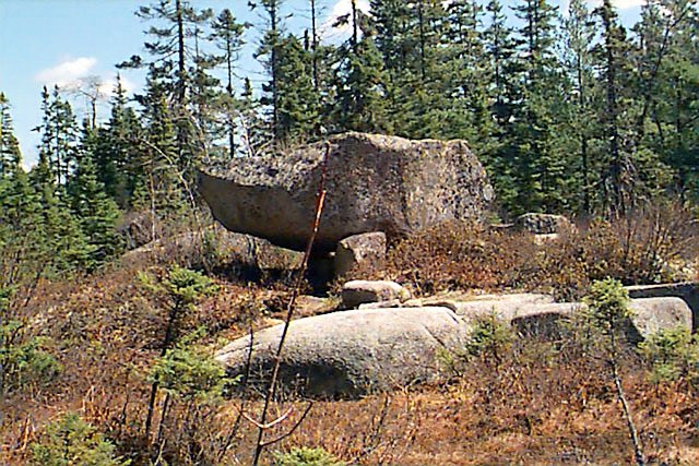
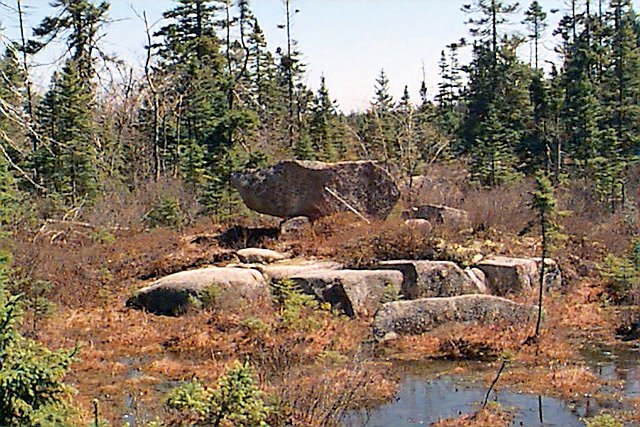
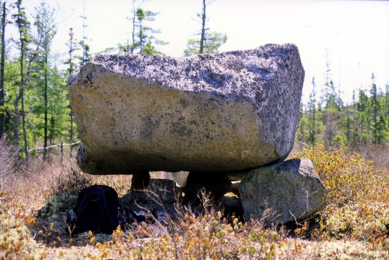
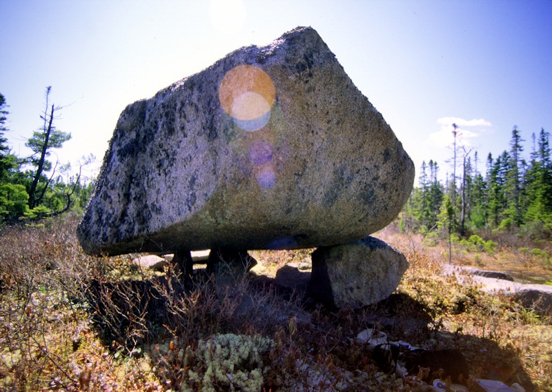
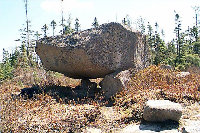
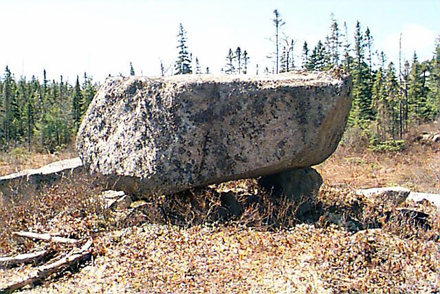
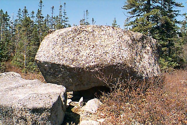
The
Dolmen "Sibley-Rock"
GPS-Coordinates:
(WGS84)
N44 49.483
W63 31.945
Winter 2002 was a long one. The ground was covered
with snow and ice well into late March. 12 April. With the first warmer
days and the snow finally gone I took off to find the Dolmen "Sibley
Rock" I heard about over the winter months. I had GPS coordinates from
a hiker marking "the strange rock" on a geocaching site. According to
those coordinates the Dolmen was "only" 3 km from the dirt trail my
little camper van was parked.
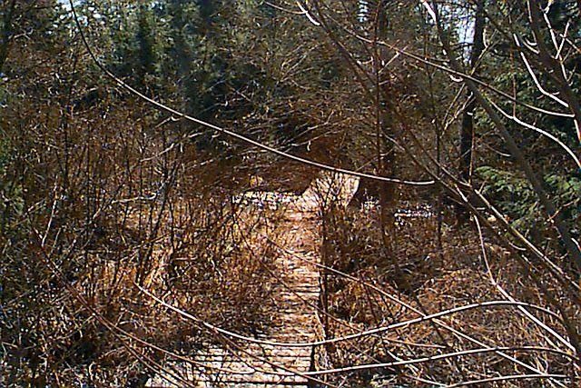
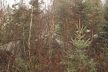
3km doesn't sound like a lot but the woods (forests for our british
crowd) in Nova Scotia are extreme thick and dense. Trails are barely
marked and the long winter sometimes erases all signs of it. 200m in
and you are stuck. Without a machete there is no going ahead. Trees and
shrubs are so dense that one has a hard time seeing the sky once you
are among them. Just check out the next photo I took alog the way.
It took me two hours to walk about 1km because I forgot my Machete at
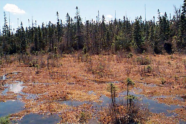
home! The ground was soaked with moisture from the winter and was more
like a swamp like anything else. I had to be careful not sink in and
get stuck. With my GPS I would have been completely lost.
To make matters worse it started to pour rain and I was soaked. After
another half a kilometer I decided to give up.
The next day wasn't better. The weather got even worse. I had to wait
at least another month until conditions improved.
The friendly CBC meteorologist said the weekend of May 4 looks nice. No
arctic cold front, no hail storms or flood waters in sight.
Early in the morning I was standing again on the trail head ready for
another "Dolmen adventure". I found another hiking trail that was in
better condition then the one I tried three weeks earlier. The trail
started out in the same direction I needed to go, so I could follow it
a little bit for about 1 km. But then it branched away from the
direction I wanted to go.
This time the ancient gods smiled onto me a bit more and I found more
of the way pointers that the GPS Geocaching site included. But the
brush was thick and nasty. This time I was smarter and brought a
machete with me.
The GPS indicated that I had managed to get about 1/3 of the way closer
to the Dolmen. I'm not the most experienced hiker and I got a bit
exhausted from the strenuous walk. What would be 1/2 hour stroll was
turned into a 3 hour hike because of the thick brush. The last
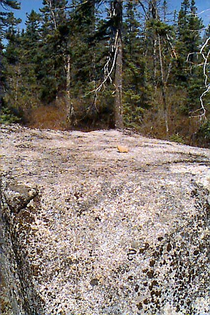
kilometer was the worst. It led through a swamp and over a huge cliff.
After 3 hours and 5km I finally arrived at the Dolmen.
Please click on a picture to
enlarge
and read the Copyright
notices, that I gathered here.
More
thoughts and infos about the Sibley Rock
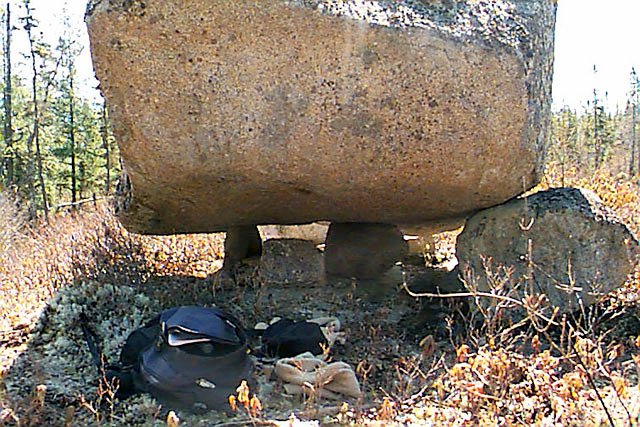
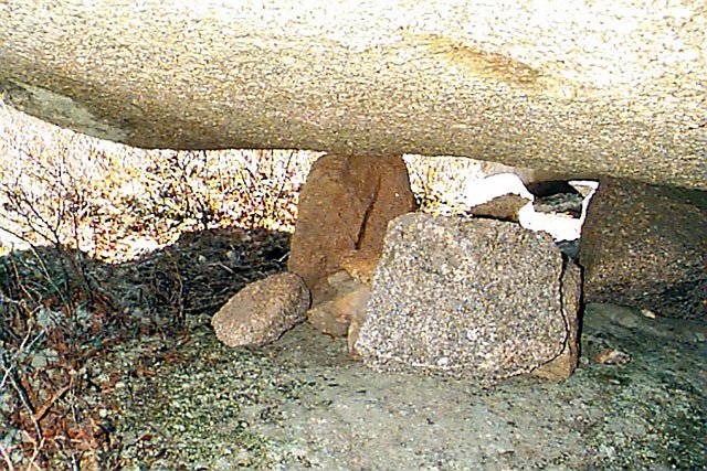
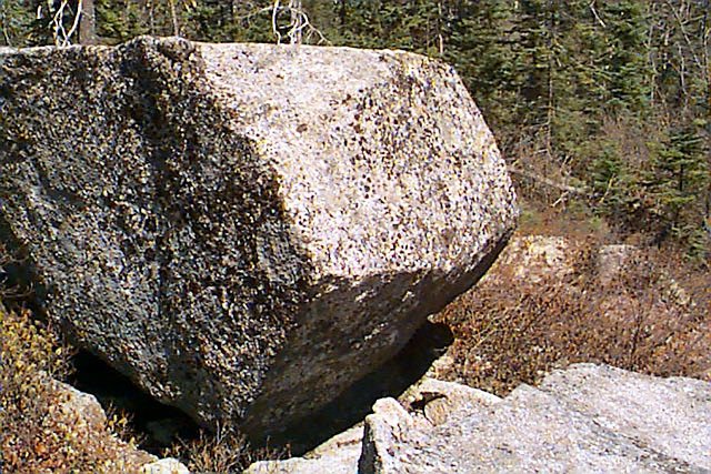
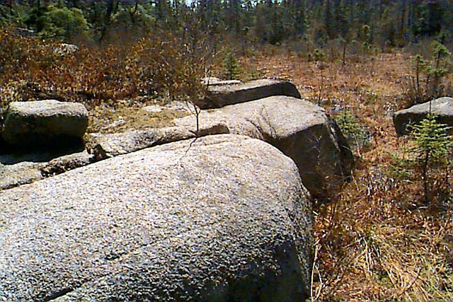
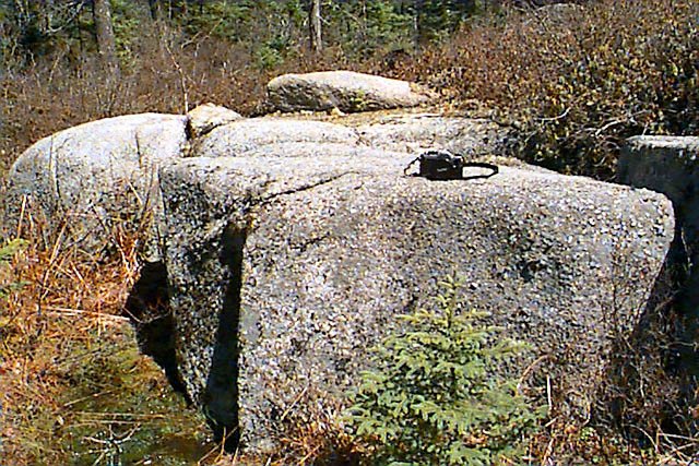
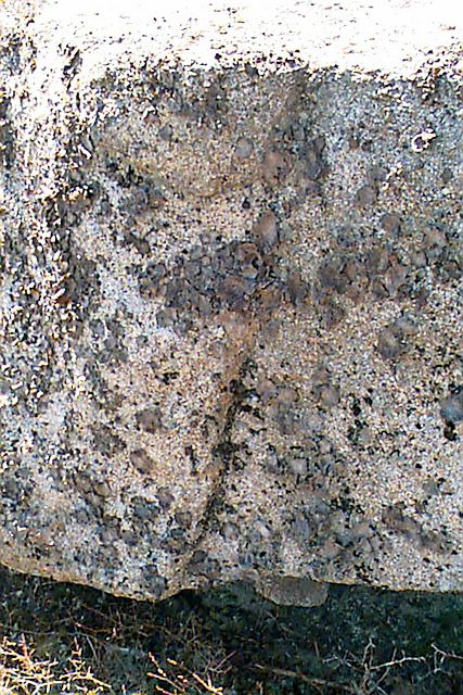
The roof stone of the Dolmen weighs about 25 tons.
The geological formations of Nova Scotia belong to the oldest on earth.
The type of Granit is the same as on the outer hebrides Islands of
"Lewis and Harris" in Scotland.
The dolmen is a "classic" Dolmen. The type can be compared with Dolmen
of France, England and other parts of Europe. But also Dolmen in Asia
e.g. Korea.
If you want to visit the Dolmen, you should be in good physical shape.
In Spring you should bring weatherproof clothes and shoes. In summer
insect repellent with deet is a definate must. You will be eaten alive
if you don't bring it.
A GPS is also VERY helpful. If you go alone, use the usual precautions
that are valid for all trips into the Canadian wilderness. Let somebody
know where you are going, bring a whistle, emergency flares and a bear
bell as there are black bear in the area. Bring lot's of drinking water
and a hat. I forgot my hat on my trip and the sun was so strong that I
got sun strocke when I got back. I was sick for a week!
Here the GPS-Coordinates for the trail (WGS84):
Trailhead : N44 51.272, W063 32.545
You will pass a bridge at: N44 50.510,
W063 32.402
The trail is getting really narrow and leads past
a survey marker at: N44 50.460, W063 32.374
Follow a very narrow footpath until you get to: N44
49.496, W063 32.177
Now it will get tricky as the visible trail
disappears completely and you will have to find your own wayl: N44
49.496, W063 32.177,
You have to climb over a rocky cliff and cross a swamp. This section is
only about 500m long, but is quite difficult.
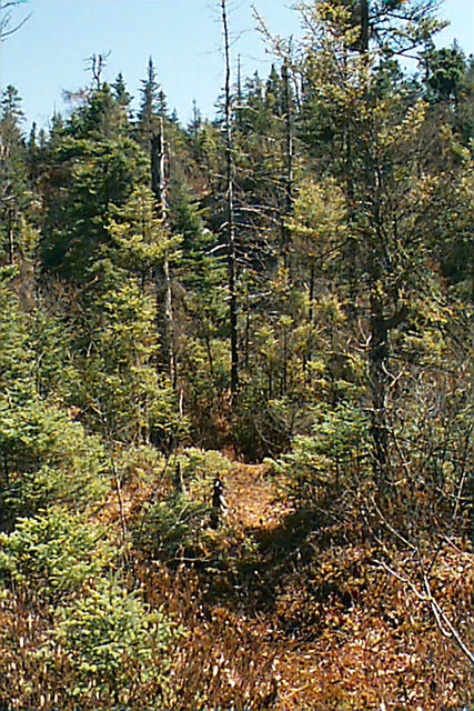
You will get to a clearing: N44 49.560,
W063 31.945
Now you will see the Dolmen. The exact coordinates are on top of this
page.
|
|